How Drought Map Was Generated
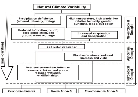
There are no clear definitions of drought exist for all environments and difficulties in recognizing and planning for drought is more difficult for policy makers, resource planners than for other disasters. Fundamentally there is a need for any drought event to understand a number of major components which capture the characteristics, risk and so the potential impacts:
- drought timing (drought initiation to drought termination);
- drought duration;
- drought severity
- drought intensity (severity / duration)
- drought frequency
- drought area

Drought monitoring captures the areal extents as well as the onset and end of a drought. Decision-makers need timely and accurate information about the development of drought conditions, the severity and recovery and most important which areas are being affected. Through drought monitoring the most vulnerable communities, economic activities and environments can be identified and preparations made to assist.
Drought indices form the bases of drought monitoring activities and through combining field and spatial data from satellite-based sensors, estimates of conditions could be generated. Limits exist to this establishing drought monitoring in many parts of the world, not least of which is:
- access and temporal frequency of data collection,
- spatial resolution,
- use of single drought indicators to represent diversity and complexity of drought conditions,
- lack of reliable drought forecasting products.


